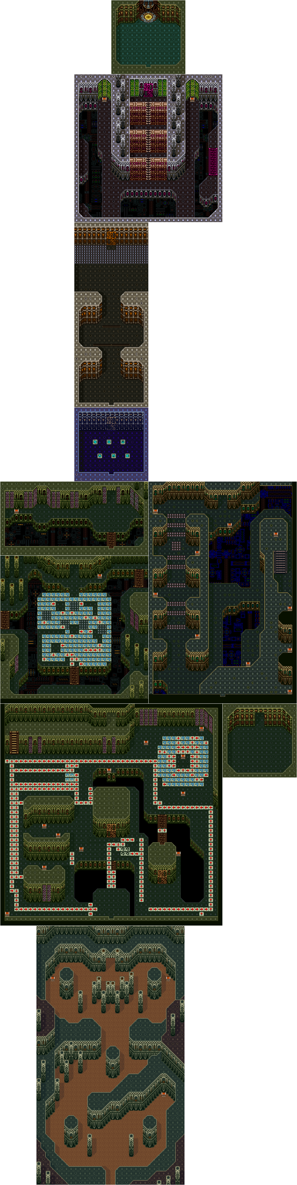
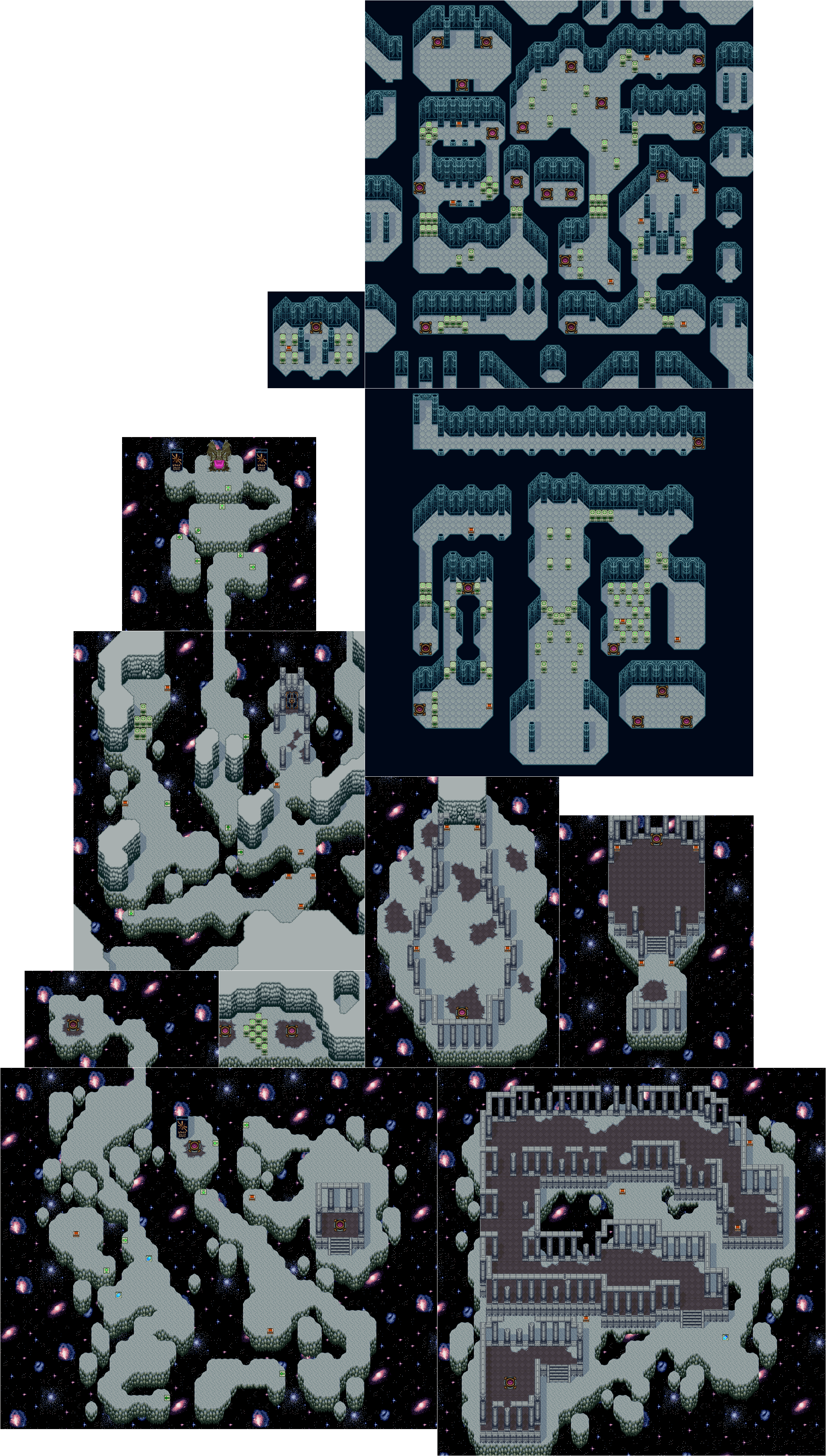
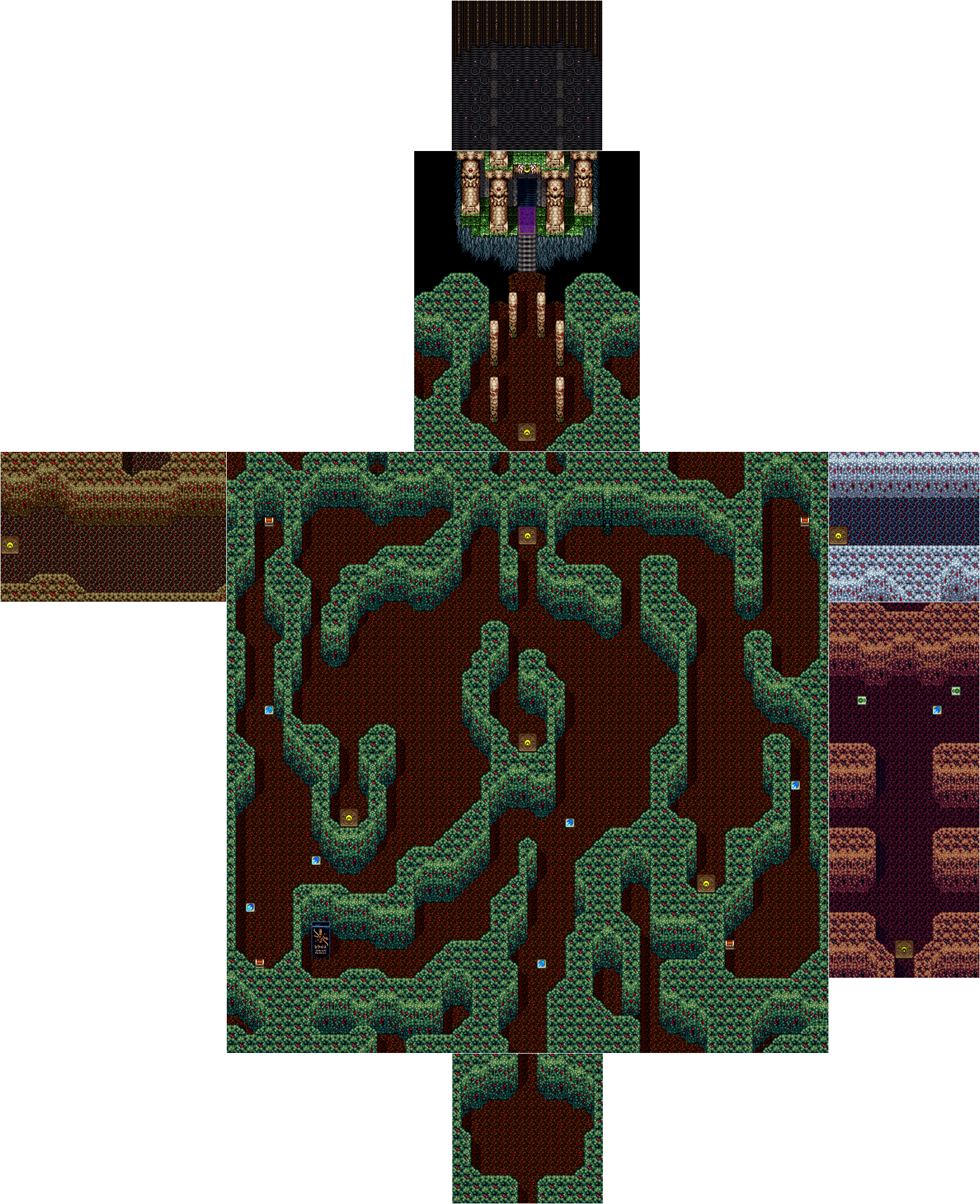
Maps
Individual Maps
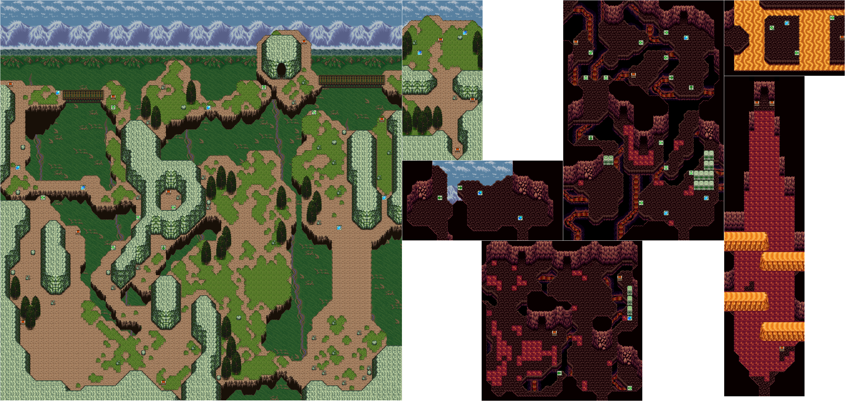
Stage 1
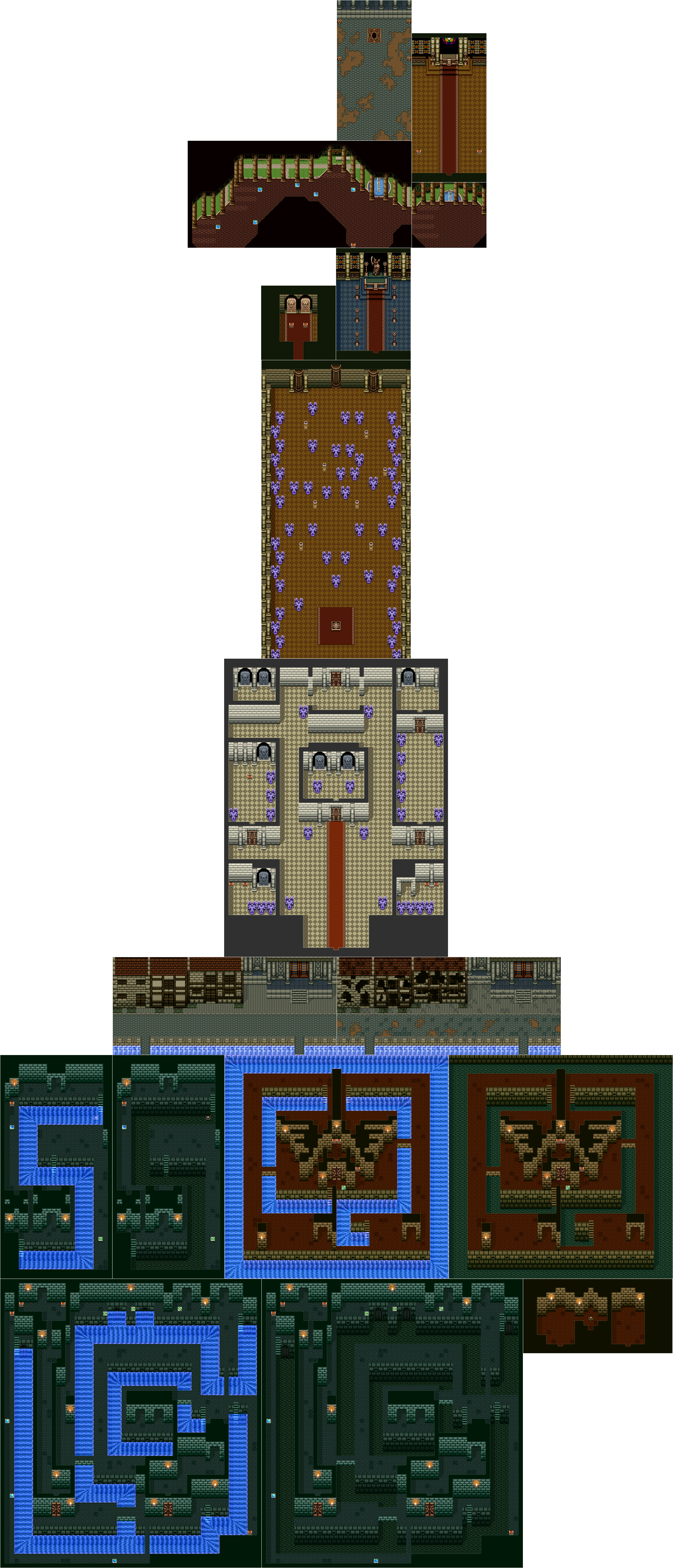
Stage 2
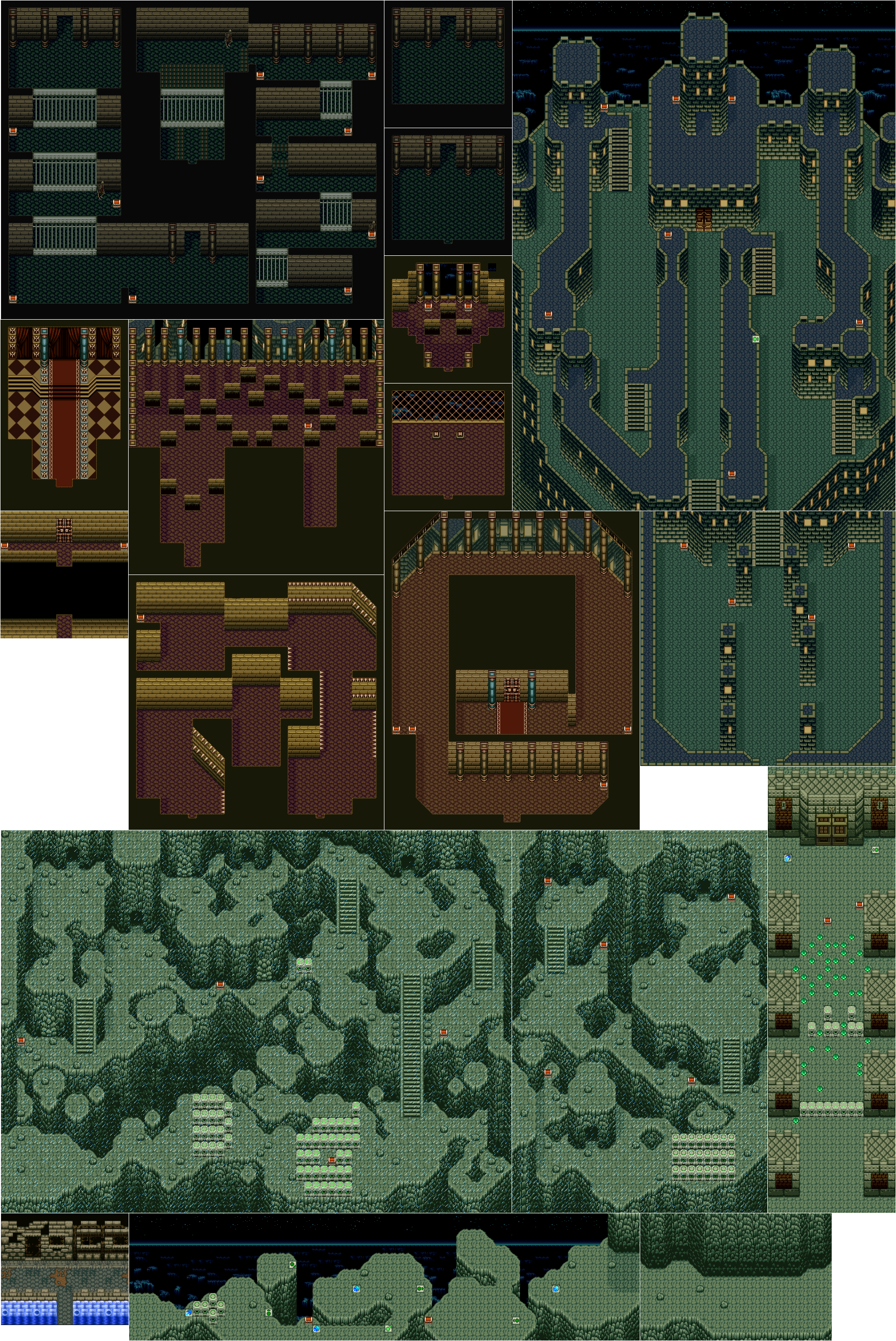
Stage 3
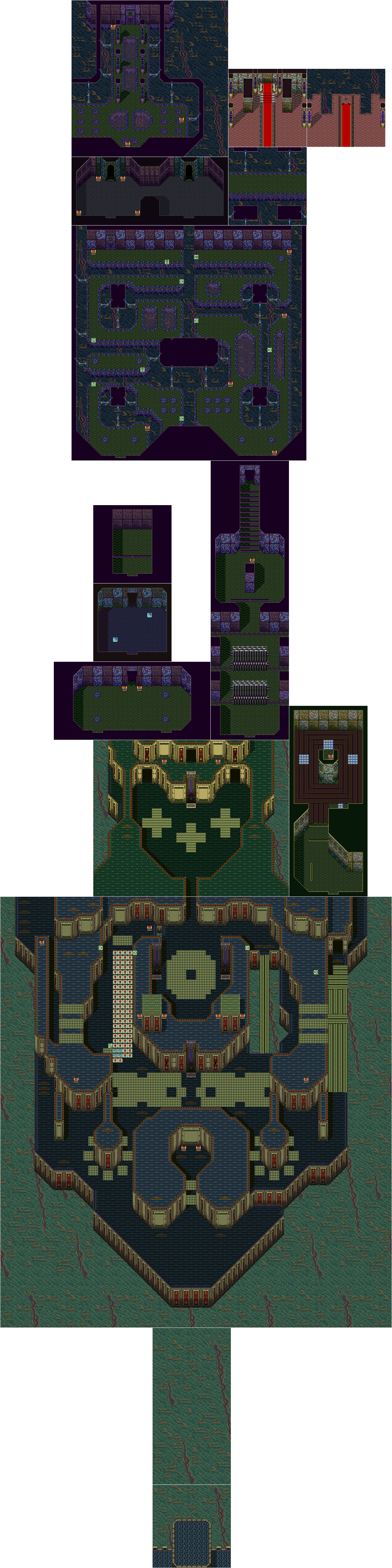
Stage 4
Stage 5
Stage 6
Stage 7
Stage 8

Print-friendly Maps
.gif) PDF Collection (Color)
PDF Collection (Color)All the maps on this page compiled into a low resolution print-friendly PDF. This is intended for previewing.
Hi-res PDF Collection (Color)All the maps on this page compiled into a high resolution print-friendly PDF. This is intended for color printers.
.gif) PDF Collection (Greyscale)
PDF Collection (Greyscale)All the maps on this page compiled into a low resolution print-friendly PDF and converted to greyscale, with hues/levels adjusted for a quality greyscale conversion. This is intended for previewing.
Hi-res PDF Collection (Greyscale)All the maps on this page compiled into a high resolution print-friendly PDF and converted to greyscale, with hues/levels adjusted for a quality greyscale conversion. This is intended for black & white printers.